The exhilaration of flying in a single-engine airplane does a number of things, the most obvious is that the ground looks so expansive. Terra firma goes on and on into the horizon. Scale and size play with my sense of proportion. What you see on the grounds looks small and yet other things seem larger than they should be. The length of highways, the relative size of cars, trucks and trains look as if they were sectioned off a sizeable display meant to be “an artist’s interpretation” of a grand project years in the making.
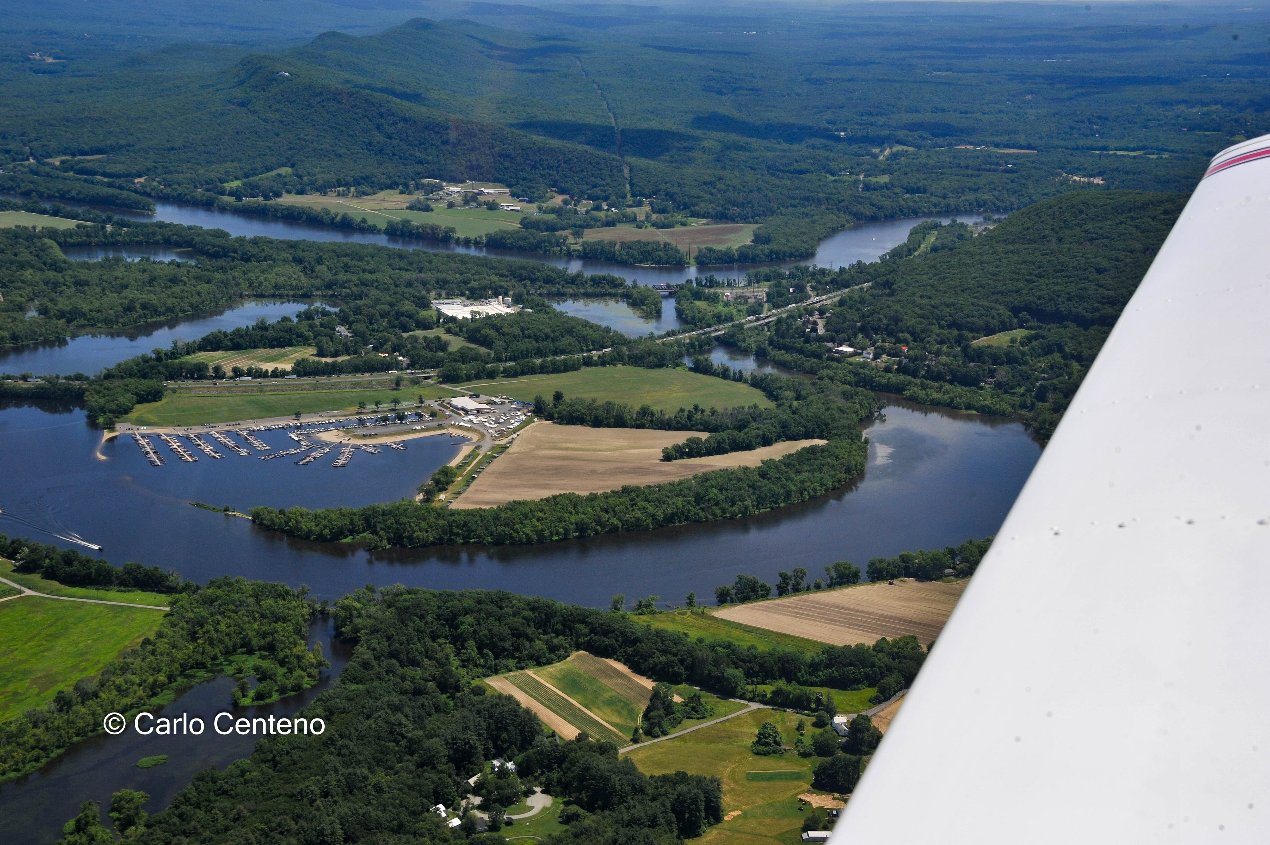
Traveling 2,000 feet above ground at speeds between 65-80 [kn] knots, it’s easy to feel overwhelmed. There are places you know of, but from the air, they take on a different personality.

Like a jig-saw puzzle on a larger-than-life scale, parcels and tracts of forested land interconnect. All appears as it should [at least through my eyes]. My friend and pilot, MP, knows more about the puzzle laid out below us. And he knows a helluva lot about flying. He’s been a pilot for well over 30 years. I don’t fly and know little of it, and it becomes more than obvious MP is very much in tune with all details pertinent to flying. Knowing weather conditions leading up to “GO” is de rigueur on his pre-flight checklist. It’s quite a checklist to say the least; I’d have to Google the majority of the terms on that lengthy list for obvious reasons.

On the ground, I have a better sense of familiar locations, most of which I’ve driven to many times already. From the air, that’s another story. Having a large river coursing across the county helps to some degree. For example, the French King Bridge is a familiar site on the road, even before actually seeing it, but from a small plane, the road looks slightly unfamiliar. Still, there’s no mistaking that beautiful cantilevered bridge.

As many of you know, the Seven Sisters are the 7 colleges located in the northeast USA. Since their founding, all are women’s colleges, but for one that went co-ed [The Harvard Annex–now Radcliffe College–is part of the Harvard Radcliffe Institute]. They remain highly regarded and very competitive schools to this day.
The 7 [in order founded] are:
o Mount Holyoke College 1837
o Vassar College 1861
o Wellesley College 1870
o Smith College 1871
o Radcliffe College 1879
o Bryn Mawr College 1885
o Barnard College 1889
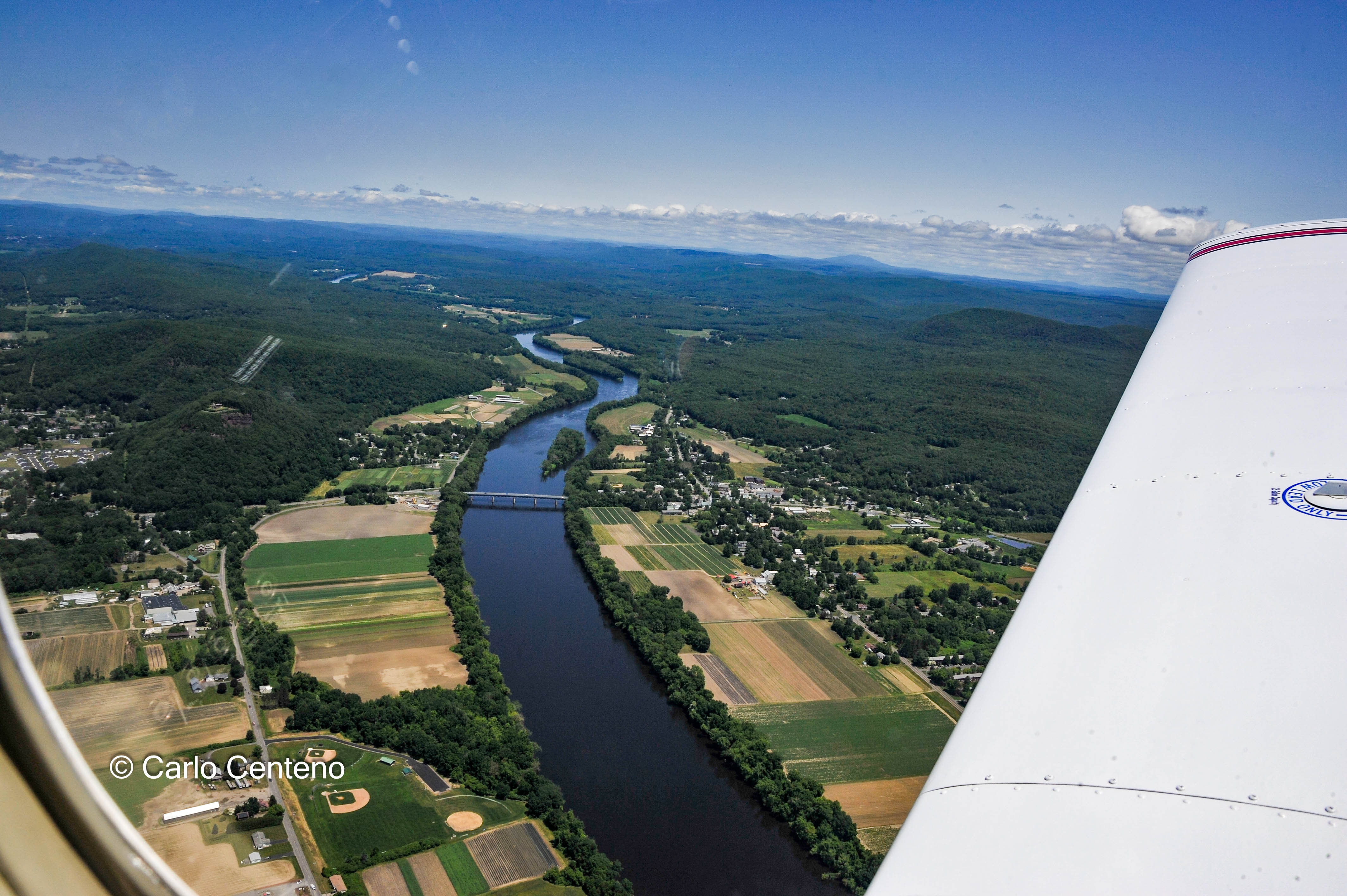

You can see Mt. Sugarloaf left of center.

Spending about 2 hours in the air was a terrific experience. Knowing MP and the way his plane is maintained, I felt confident and safe in his hands. It was a rare, bright day with a slight on-off breeze, perfect for just about anything. My time at 2,000 feet allowed for some R&R, plenty of “what-have-you-been-doing” conversations, a chance to take some photos and moments to appreciate all that is life, the good and not so good, the rote and the unpredictable.
Hope all your journeys are safe….
